
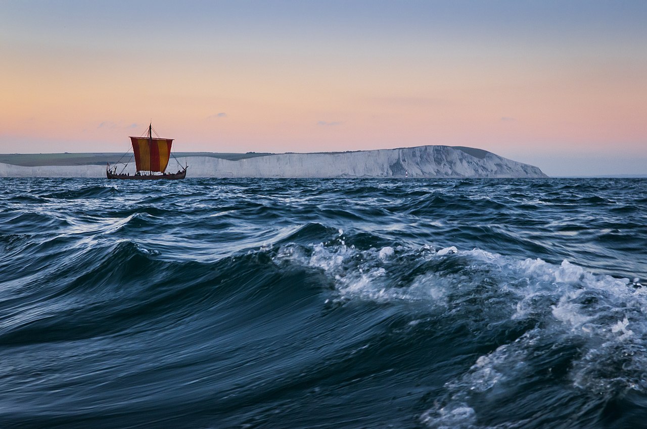
Norse sailors crossed the North Atlantic to Iceland, Greenland and Newfoundland without a magnetic compass; the instrument didn’t reach Northern Europe until well after the Viking Age ended. So how did Vikings navigate open water, out of sight of land, for days at a time? With a working combination of memorized sailing directions, sharp observation, and experience passed from captain to crew.
Viking Navigation at a glance
- No magnetic compass — it reached Northern Europe only after the Viking Age
- Sailing directions were memorized, not charted, and passed down by word of mouth
- Latitude sailing kept ships on a steady course using the sun and Polaris
- The “sunstone” (sólarsteinn) is plausible physics, but unconfirmed on any Viking-Age wreck
- The Vegvisir symbol is 19th-century folklore, not a Viking Age navigation tool
Dead Reckoning and Coastal Piloting
Most Viking-Age voyages hugged the coast whenever they could. Along Norway’s fjord-cut shoreline, captains piloted by landmarks — mountains, islands, river mouths — sailed and re-sailed for generations until they became a mental chart nobody needed to draw. For open-water crossings, where land dropped out of view entirely, sailors fell back on dead reckoning: tracking speed, heading and elapsed time to estimate position, the same basic method used by seafarers everywhere before satellite positioning.
Sailing directions surviving in Icelandic texts like the Landnámabók and Hauksbók describe exact routes in these terms. One well-known example keeps a course from Hernar in Norway that passes south of the Shetlands and north of the Faroes to reach Iceland’s east coast, specified as bearings and day-counts, not fixed coordinates in the modern sense. A knarr — the broad, deep-hulled cargo ship used for these crossings, distinct from the sleeker Viking longship — typically covered a North Sea crossing to Iceland in about a week given fair winds, and a captain (styrimaður) usually learned the routes for years as a crew member before he was trusted to hold the steering oar on his own.
Judgment still failed, and the sagas are honest about it. The Greenlanders’ Saga credits Bjarni Herjólfsson with the first known sighting of land west of Greenland, around 986 CE, purely by accident: blown off his intended course by fog and a shift in wind, he sighted an unfamiliar, forested coastline, didn’t go ashore, and simply corrected back toward his original destination. Leif Erikson is said to have bought Bjarni’s ship and followed up on the sighting deliberately years later. Dead reckoning got Norse sailors most of the way there; sometimes what filled the gap was a wrong turn that happened to work out.
Latitude Sailing by Sun and Stars
For longer hauls, like Norway to Greenland, sailors used a technique historians call latitude sailing: hold a constant north-south position by checking the sun’s height at midday, or Polaris’s altitude at night, against a remembered reference, then sail due west until landfall appears. It requires no instrument, just consistent observation and a memorized reference height, which is also why Norse sailing directions read like recipes rather than coordinates — “keep so far south that birds and whales are visible” is a typical instruction.
This also explains a pattern in Norse expansion across the Atlantic: Iceland, southern Greenland and Newfoundland all sit at broadly similar distances from the pole, a narrow, repeatable band that latitude sailing made possible to hold. Stray from that band without realizing it, and a captain could sail past his target entirely into open ocean, which is very likely what happened to Bjarni Herjólfsson and to Garðar Svavarsson, another sailor the Landnámabók credits with an early, weather-forced sighting of Iceland before anyone set out to find it on purpose.
Wear it: Viking Symbols
Premium Norse-inspired apparel, made on demand.
🇺🇸 Fast US shipping · 🇪🇺 Ships across the EU · 🔒 Secure checkout
The Sun-Shadow Board and the Sunstone Debate
In 1948, archaeologists recovered a fragment of a wooden disc from Uunartoq fjord in Greenland, marked with lines some researchers read as a gnomon for tracking a shadow’s direction, essentially a sun-compass. The interpretation is genuinely contested; other archaeologists argue the fragment could be part of a sundial, a decorative disc, or even a game board, and no complete example survives to settle the question.
The sunstone is murkier still. Icelandic sagas mention a sólarsteinn used to find the sun’s position on overcast days, and calcite crystals like Iceland spar genuinely can do this: their birefringence splits polarized skylight in a way that reveals the sun’s bearing even through cloud, a property confirmed in modern lab tests. But no sunstone has ever been recovered from a confirmed Viking-Age ship burial or wreck. The closest real archaeological find, a calcite crystal from the Alderney shipwreck, dates to the 16th century, centuries after the Viking Age closed.
Birds, Whales and the Color of the Water
The Landnámabók credits Hrafna-Flóki, “Raven-Flóki,” with using birds to find Iceland: he released ravens at sea and watched what they did. If they flew back to the ship, land was still far off; if they circled without committing, it was near but unclear; if they struck out in one direction and kept going, he followed. It’s a saga tradition rather than a contemporary log entry, but using land-seeking birds as a natural compass has real precedent in seafaring cultures worldwide.
Norse sailors also read whale migration patterns, shifts in water color and temperature near coastlines, drifting seaweed, and the clouds that pile up over islands long before the islands themselves appear. Certain seabirds, like auks and gulls, rarely stray far from land, so spotting them in numbers was itself a useful signal, distinct from the deliberate raven-release method Flóki reportedly used. None of this involved Huginn and Muninn, Odin’s own mythic information-gathering ravens, but the coincidence of ravens and navigation shows up more than once in Norse tradition, from Flóki’s birds to Odin’s.
Why the Vegvisir Is Not a Viking Navigation Tool
The eight-armed Vegvisir symbol gets marketed constantly as an authentic “Viking compass,” but it isn’t Viking Age at all. Its earliest known appearance is in 19th-century Icelandic manuscripts, most notably the Huld manuscript from 1860, roughly eight centuries after the Viking Age ended, as part of a folk-magic tradition of protective staves rather than a seafaring instrument. The name translates loosely to “way guide,” which is almost certainly why the navigation myth attached itself so easily. It’s a genuinely interesting piece of later Icelandic folk magic, just not evidence of how Viking sailors actually crossed open water; our full Vegvisir guide covers its real, more recent history.
Quick Answers
Did Vikings have a compass? No. The magnetic compass reached Northern Europe after the Viking Age ended. Norse sailors used the sun, stars, dead reckoning and memorized sailing directions instead.
Is the Viking sunstone real? The physics behind it is real — calcite crystals like Iceland spar can locate the sun through cloud cover — but no sunstone has ever been found on a confirmed Viking-Age ship or wreck.
Is the Vegvisir a genuine Viking symbol? No. It first appears in 19th-century Icelandic folk-magic manuscripts, centuries after the Viking Age, as a protective stave rather than a navigation tool.
How did Vikings find Iceland and Greenland? Mostly through latitude sailing, holding a constant course by the sun and stars, combined with memorized sailing directions and natural signs like birds and whale movement.

 History Warrior Team


